Hiking the Quilotoa Loop

People often ask me if I EVER get nervous or scared and the answer is HELL YES ALL THE TIME. It’s one of my favourite places to be, especially when I reflect back and think of all the times I risked going too far, or did something outside of my “comfort zone”, or really just pushed the boundaries of what was possible; those are generally the times where I’ve had the most interesting, often times hilarious, and memorable experiences.
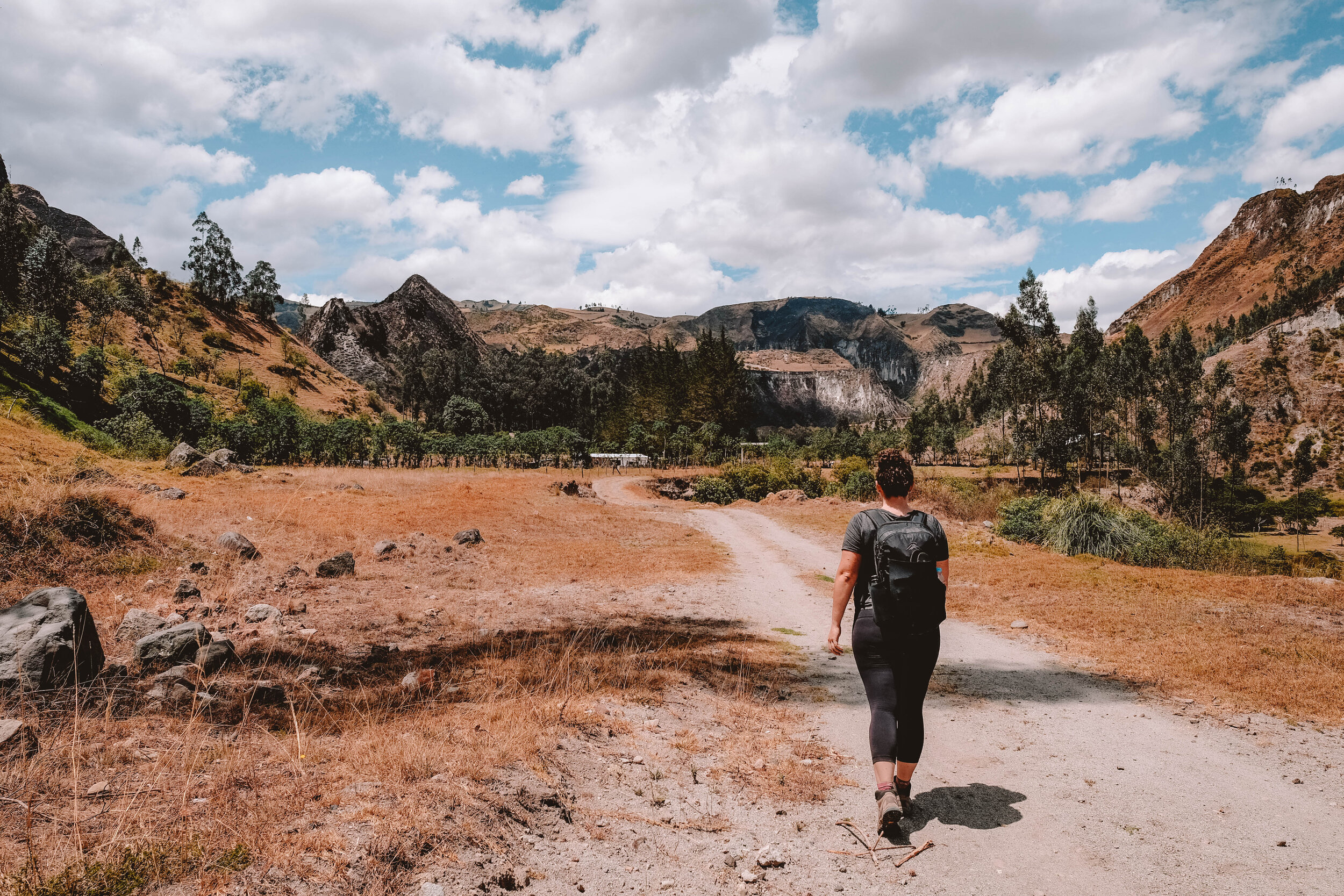
For me choosing to hike the Quilotoa loop solo was definitely smack bang in nervous/scared category for me. As usual I’ve done sweet fuck all research, but I did manage to download another traveller’s maps.me route before arriving and I’m just going to roll with that. So, I think I’m smart and have a bus direct from Baños to Quilotoa only to arrive and find out there are no buses from Quilotoa to Sigchos on Sundays (where I’ll be starting the hike); some research would have come in handy there LOL, so I’m forking out $25 and the brother of the chick at the hostel is driving me there to save the hassle of going back to Latacunga, and wasting hours on buses retracing my steps.
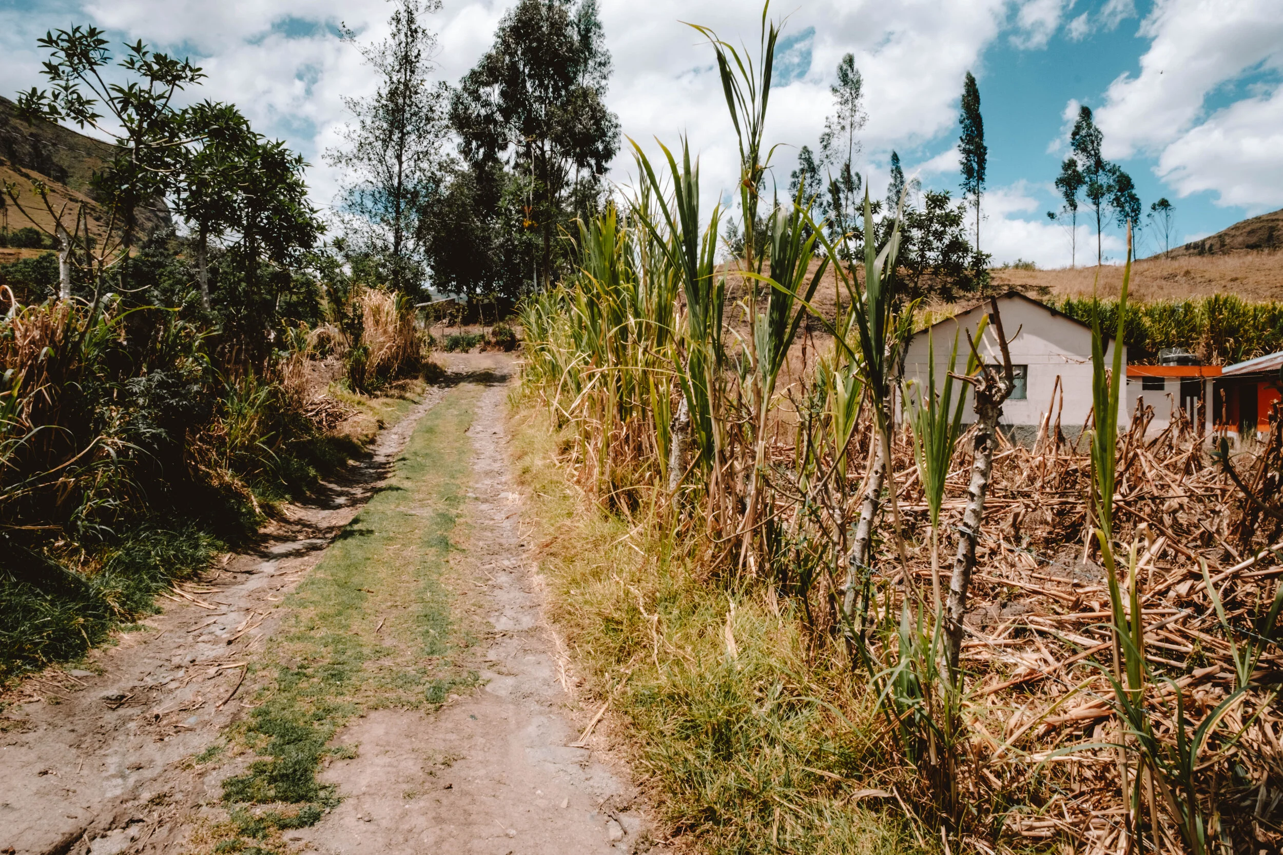
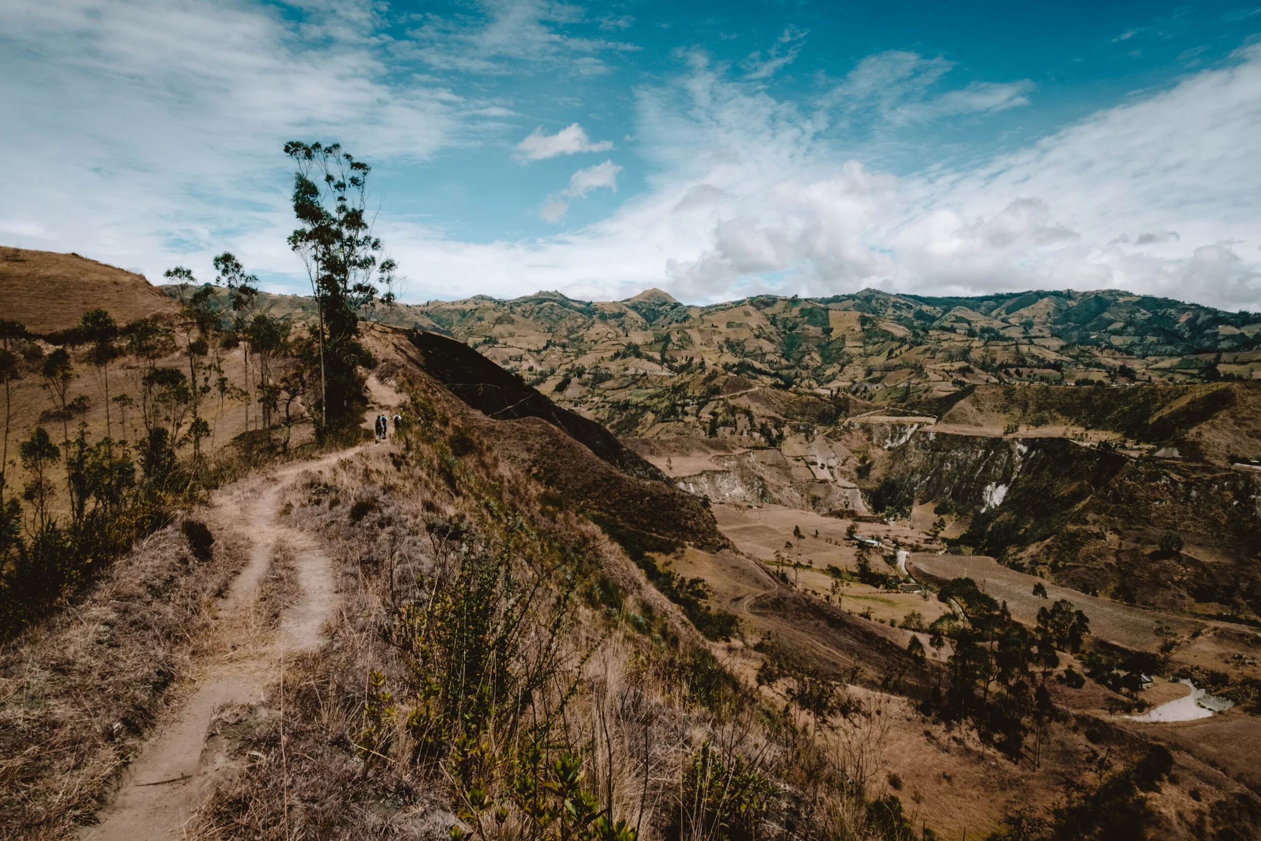
Turns out the trail is relatively well marked. I only go off piste twice on my first day and luckily realise pretty quickly (thanks to some dude called James Connell who bothered to mark the route on maps.me - thank you James), so there’s not too much back tracking. The first day is pretty sweet. Starts of mostly downhill weaving between little villages and farming communities down to the river and a tonne of switchback to scale the mountain up to Isinlivi. You pass locals coming from the opposite direction, usually herding cattle, going to church or heading to town, and so the usual greetings ensue “buenos dias”, “buenas tardes”. Some even yell out from their farms to ask if you’re heading to Isinlivi and validate you’re heading in the right direction.


I only saw two other tourists early on, who I overtook, and the rest of the time I had the trail pretty much to myself apart from a few exchanges with some locals I met along the way. It’s really cool being out here conversing in (for me, very basic) Spanish where you can’t fall back on English because the locals don’t speak it. I make it to Isinlivi in time for lunch. Thank fuck it didn’t take me the expected time because I was starving and forgot to pack food LOL - details that evaded me due to lack of research / planning.


Thanks to the recommendation from some girls I met in Montañita in July I’m staying at Llu Llu Llama hostel is Isinlivi for the suggested 2 nights instead of rushing through. Great advice; the town is cuuuuuute and the hostel is even cuter. I’m in a dorm, but not really because it’s almost like my own cute little thatched roof room with a sarong for a door. And even better there is a jacuzzi to relax in at the end of the day that looks out to the mountains I’ll be hiking after my little respite here.
The hostels along this route all include breakfast and dinner which is all served family style, and over dinner I meet some French Texans who invite me to join them on a horse ride in the morning to a local market in Guantualo. I have a day off hiking and the Guantualo market, which only happens on Mondays, is the most remote, authentic and non-touristy of all Quilotoa Loop markets so I’m in 100%.


Travelling to Guantualo on horseback made a nice change from traversing the area by foot. Not having to watch where I’m walking, or catch my breath on the ascents allowed me to soak up the beautiful scenery as we wound down the mountain from Isinlivi to the river and then back up again through traditional farmlands to Guantualo. Along the way we pass locals on their way back from the market with freshly purchased livestock, pigs, sheep etc.


The villages in this area are usually quite tranquil and almost feel deserted so it was amazing to see Guantualo transformed into a hive of activity as local indigenous people from surrounding mountain villages gather to sell and purchase their wares. This particular market is known for livestock and the local butcher even slaughters an animal in the middle of the market and sells it piece by piece. By the time I arrived I couldn’t tell if it was llama or sheep anymore but it was almost well and truly all sold off.


It’s incredible really; apart from 2 other people, we were the only tourists which was such a cool thing to be a part of. I really felt like I was so far removed from all the touristy places I’ve been and was experiencing something truly authentic. The women looked gorgeous in their black skirts, beautiful shawls and of course wearing their traditional hats, some with peacock feathers. A number of the men also had feathers adorning their hats: the place to be, and be seen. And bonus, the empanadas were only 10c - cheapest I’ve had so far.


Dinner conversation “family style” can get quite interesting as various cultures merge together at the table, and it’s not unusual to end up talking about Trump, Brexit, gun laws, legalisation of marijuana, the economy of war, climate change and a whole plethora of other random topics. It makes for some interesting evenings that’s for sure, accompanied by the local beer of course, or the Llu Llu Llama specialty hot chocolate which is dosed with whisky and amaretto - delish. Perfect way to cap off an evening in the mountains.
So, my two nights here draw to a close and I’m strapping my hiking boots back on ready to tackle the mountains again by foot. The hostel has packed me a lunch, which I struggle to fit in my bag, yet again because I just threw crap in without thinking - a lot of which I won’t need like gloves, beanie, fleece, thermals, head torch: WTF was I thinking? I guess if a random cold front comes through or I decide I wanna hike at night I’ll be well prepared.
Met some fellow solo travellers at Llu Llu Llama so we set off in the morning to tackle Isinlivi to Chugchilan together. They were all fitter than me so it was good to get a little push. The morning started off easy with a hike down into the valley and then a relatively steady climb back up again. The views are just completely insane and nothing like what you can see from the road. Throughout the morning we run into people we’ve met over the preceding days all headed in the same direction, albeit at differing paces, and some following slightly different routes. After passing through Itualo we have a steep climb back up the canyon to another amazing lookout where we stop for lunch. It’s been 3 hours, we’ve smashed out the tough stuff so we cruise after lunch just enjoying the surrounds, chatting to some locals, eating fruit and playing with the dogs that come join us for parts of the walk.


I was super organised and pre-booked accom along the route, which was completely unnecessary as it’s low season and there are a tonne of rooms available. So I’m staying at a different joint to the rest of my fellow hikers which allows me the time to just completely chill in the hammock and soak in the amazing views of the canyon I’ll be hiking through tomorrow. After a hearty brekkie they pick me up bright and early and we take off headed to Quilotoa. Today is meant to be the toughest day so I am imagining the WORST as most of it is uphill. Turns out it’s not too bad, but we do have over 1000m elevation gain which was definitely a challenge for the lungs.
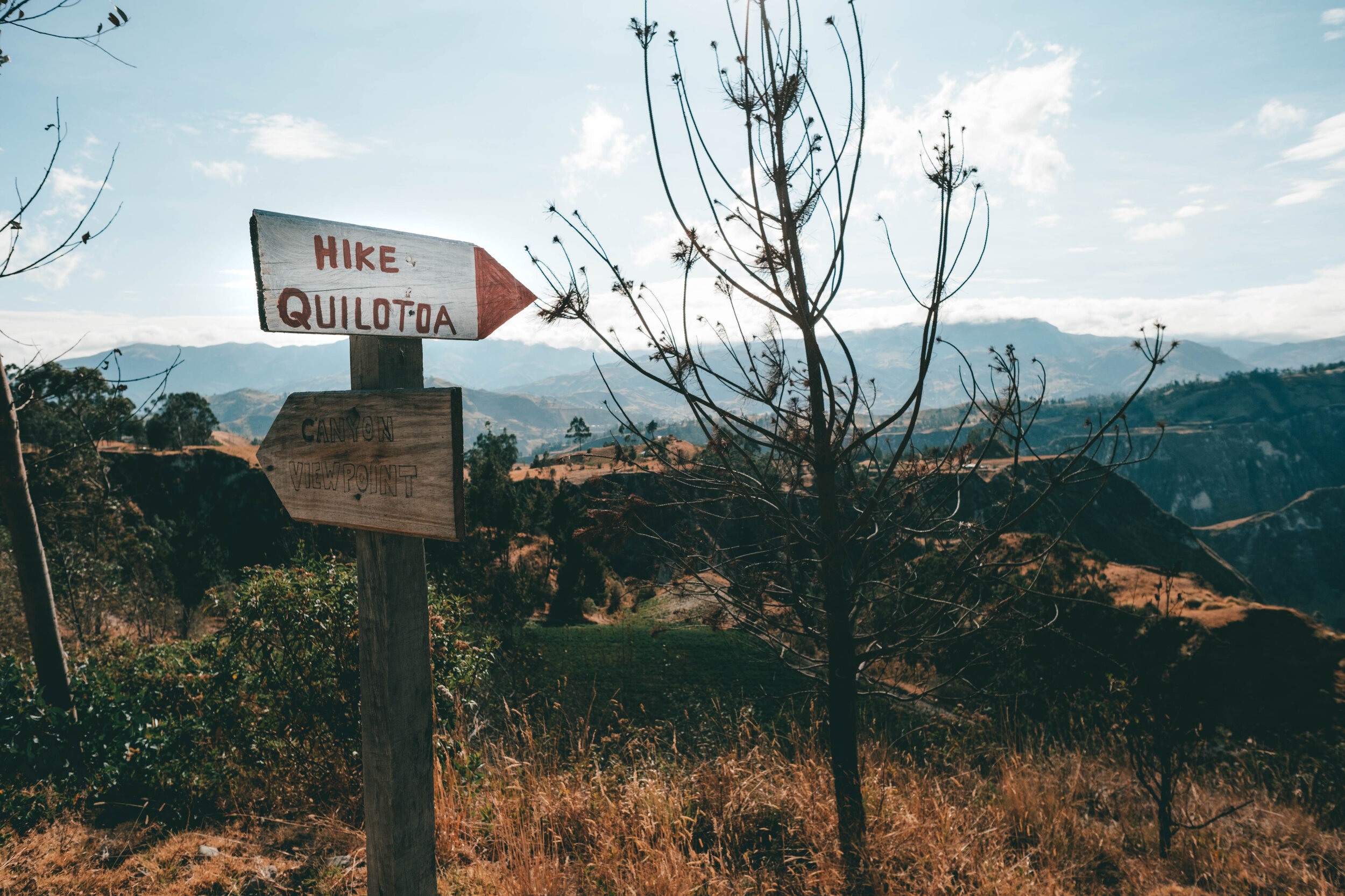


Like the other two days the morning kicks off with a descent into the valley, followed by a steep climb back up. One of the dogs from the hostel showed us a shortcut which we followed diligently as we scaled up the side of the road. Once we passed through La Moya village we came out to a clearing with the most spectacular view with Chugchilan behind us and Quilotoa a few hours ahead. From here it’s down, up, down, up and after a few more hours of hiking uphill we reach the crater edge of Quilotoa and the views are breathtaking.

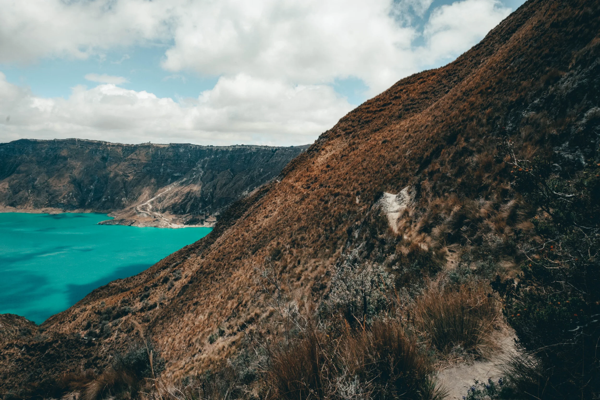


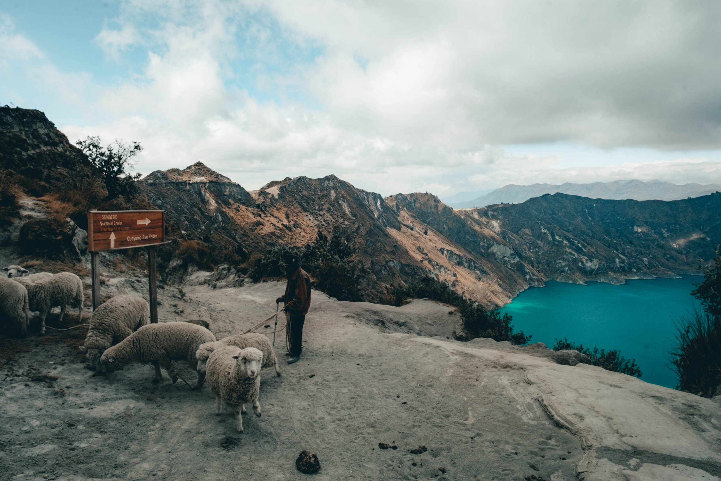
After getting absolutely smashed by sand and wind while admiring the view, we take off for what should be about an hour hike to Quilotoa village. BUT, instead of taking the signed route which looks way too fucking steep, we take the left hand path along the crater edge. Turns out it was more like 2 hours by taking this route with some pretty steep drops from the path edge and a lot of deliberation about which paths to follow every time we came to a fork in the road. Also we ended up having to climb even more as this path took us half way down the crater… so by trying to avoid climbing I think we actually made it worse for ourselves. Totally worth it though as the views were to die for. Literally… a woman got blown off the path the other day and there is a guy who has been missing since Friday last week!!